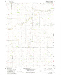
1979 Map of Delmont NE
USGS Topo · Published 1980About this map
The agrarian landscape of Hutchinson Co at the end of the 1970s is defined by its subtle drainage networks and the intersection of established townships. The map documents the rural character of Washington and Susquehanna townships, where the prairie is etched by the meandering paths of Twelvemile Creek, its South Fork, Coffee Creek, and Pony Creek. This drainage system reveals the natural hydrology that supported South Dakota's homesteading history and subsequent agricultural development.
Find a feature on this map
16 named features on this map. Tap any name to fly to it.
Don’t see what you’re looking for? This feature index may not catch every label — zoom into the map to look around manually.
Map Details
Editions of this 1979 Delmont NE Map
This is the sole edition of this map. No revisions or reprints were ever made.
Other maps of this area

1898 · Olivet
USGS Topo · 1:125,000

1899 · Mitchell
USGS Topo · 1:125,000

1899 · Alexandria
USGS Topo · 1:125,000

1955 · Sioux Falls
USGS Topo · 1:250,000

1955 · Mitchell
USGS Topo · 1:250,000

1957 · Ethan
USGS Topo · 1:24,000

1958 · Sioux Falls
USGS Topo · 1:250,000

1959 · Mitchell
USGS Topo · 1:250,000

1979 · Delmont
USGS Topo · 1:24,000
1979 · Delmont SE
USGS Topo · 1:24,000
Featured Places
- Lincoln Township, SD
- Starr Township, SD
- Tobin Township, SD
- Susquehanna Township, SD
- Washington Township, SD