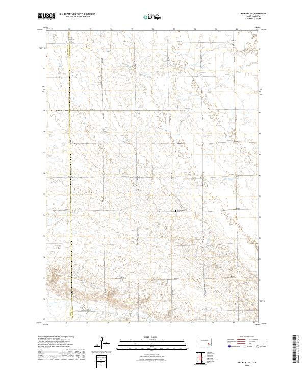
2021 Map of Delmont SE
USGS Topo · Published 2021About this map
Agricultural lands along the Douglas and Hutchinson county line are defined by a regular grid of section roads and the seasonal drainage of the James River basin. This survey highlights the rural persistence of small community landmarks, notably three distinct burial grounds that anchor the landscape: Saint Marys Cem in the northwest, Elgenfield Cem to the northeast, and Hoffnungsberg Cem central to the quadrangle. The terrain is subtly shaped by the headwaters of the North Branch Dry Creek and South Branch Dry Creek, which meander through the prairie sections. The map provides a detailed view of the local infrastructure, from the north-south corridors like 407th Ave to the east-west township roads such as 280th St, documenting the precise boundary between Township 99 North and its neighbors.
Find a feature on this map
27 named features on this map. Tap any name to fly to it.
Don’t see what you’re looking for? This feature index may not catch every label — zoom into the map to look around manually.
Map Details
Editions of this 2021 Delmont SE Map
This is the sole edition of this map. No revisions or reprints were ever made.
Other maps of this area

1898 · Olivet
USGS Topo · 1:125,000

1955 · Sioux Falls
USGS Topo · 1:250,000

1955 · Mitchell
USGS Topo · 1:250,000

1958 · Sioux Falls
USGS Topo · 1:250,000

1959 · Mitchell
USGS Topo · 1:250,000

1977 · Oak Hollow
USGS Topo · 1:24,000

1978 · Oak Hollow
USGS Topo · 1:24,000
1978 · Greenwood Colony
USGS Topo · 1:24,000
1978 · Tripp
USGS Topo · 1:24,000

1979 · Delmont
USGS Topo · 1:24,000
Featured Places
- Belmont Township, SD
- East Choteau Township, SD
- Oak Hollow Township, SD
- Kulm Township, SD
- Susquehanna Township, SD