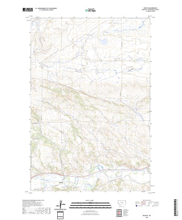
2024 Map of Delphia
USGS Topo · Published 2024About this map
Delphia lies at the heart of this landscape, situated along the northern banks of the Musselshell River. The terrain is defined by a dense network of coulees and drainages that feed into the river valley, including McLean Coulee and Fatty Creek. The infrastructure reflects the ranching and agricultural heritage of Musselshell County, with long trails like the Sheepherder Trl and Painted Horse Trl traversing the uplands between Sand Creek and the river bottoms. This modern topographic study shows the persistent importance of water sources in the high plains, evidenced by features such as Fourmile Springs and the winding course of North Willow Creek. The road network, including Goffena Rd and Delphia Rd, connects the scattered settlements and ranch lands of this river valley community.
Find a feature on this map
20 named features on this map. Tap any name to fly to it.
Don’t see what you’re looking for? This feature index may not catch every label — zoom into the map to look around manually.
Map Details
Editions of this 2024 Delphia Map
This is the sole edition of this map. No revisions or reprints were ever made.
Other maps of this area

1954 · Roundup
USGS Topo · 1:250,000

1958 · Roundup
USGS Topo · 1:250,000

1963 · Musselshell
USGS Topo · 1:24,000
1963 · Akers Ranch
USGS Topo · 1:24,000

1963 · Musselshell NW
USGS Topo · 1:24,000

1963 · Delphia
USGS Topo · 1:24,000

1979 · Roundup
USGS Topo · 1:100,000

1979 · Corey Flat
USGS Topo · 1:24,000

1979 · Gage NE
USGS Topo · 1:24,000

1979 · Chimney Butte
USGS Topo · 1:24,000