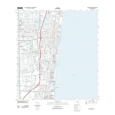
2012 Map of Delray Beach
USGS Topo · Published 2012About this map
Yamato and the surrounding coastline of Palm Beach County appear here as a dense network of residential waterways and golf courses during the early 2010s. The landscape is defined by the Intracoastal Waterway and its numerous finger canals serving neighborhoods like Tropic Isle, Boca Harbour, and Bel Marra. This era shows the heavy integration of transport and leisure, with Florida's Turnpike and I-95 running parallel to the historic Florida East Coast Railway.
Find a feature on this map
33 named features on this map. Tap any name to fly to it.
Don’t see what you’re looking for? This feature index may not catch every label — zoom into the map to look around manually.
Map Details
Editions of this 2012 Delray Beach Map
This is the sole edition of this map. No revisions or reprints were ever made.
Other maps of this area

1945 · Greenacres City
USGS Topo · 1:24,000

1945 · Lake Worth
USGS Topo · 1:24,000

1946 · West Dixie Bend
USGS Topo · 1:24,000

1946 · Boca Raton
USGS Topo · 1:24,000

1947 · Delmar Farms
USGS Topo · 1:24,000

1949 · Lake Worth
USGS Topo · 1:24,000

1949 · West Dixie Bend
USGS Topo · 1:24,000

1949 · Delmar Farms
USGS Topo · 1:24,000

1950 · Boca Raton
USGS Topo · 1:24,000

1950 · Delray Beach
USGS Topo · 1:24,000