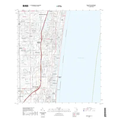
2021 Map of Delray Beach
USGS Topo · Published 2021About this map
The Intracoastal Waterway and the Atlantic Ocean define the eastern edge of this modern landscape, where coastal communities like Highland Beach and Gulf Stream are separated from the mainland by a complex network of channels. Inland, the suburban expansion of Delray Beach and Boca Raton is evident, organized around major transit corridors and water features such as Lake Ida and the El Rio Canal. The map reveals the civic and educational infrastructure supporting these growing cities, from the Palm Beach South County Courthouse to Everglades University and the Digital Media Arts College.
Find a feature on this map
44 named features on this map. Tap any name to fly to it.
Don’t see what you’re looking for? This feature index may not catch every label — zoom into the map to look around manually.
Map Details
Editions of this 2021 Delray Beach Map
This is the sole edition of this map. No revisions or reprints were ever made.
Other maps of this area

1945 · Greenacres City
USGS Topo · 1:24,000

1945 · Lake Worth
USGS Topo · 1:24,000

1946 · West Dixie Bend
USGS Topo · 1:24,000

1946 · Boca Raton
USGS Topo · 1:24,000

1947 · Delmar Farms
USGS Topo · 1:24,000

1949 · Lake Worth
USGS Topo · 1:24,000

1949 · West Dixie Bend
USGS Topo · 1:24,000

1949 · Delmar Farms
USGS Topo · 1:24,000

1950 · Boca Raton
USGS Topo · 1:24,000

1950 · Delray Beach
USGS Topo · 1:24,000