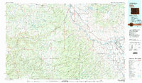
1980 Map of Delta
USGS Topo · Published 1980About this map
The Gunnison River and Uncompahgre River define the agricultural and transit corridors of this Western Slope region, converging at the town of Delta. Here, the irrigated valley floor supports rural crossroads like Pea Green Corner and Hookers Corner, contrasting sharply with the massive uplift of the Uncompahgre Plateau and Grand Mesa. The Denver & Rio Grande Western RR follows the river canyon, passing remote points such as Bridgeport and Broughton.
Find a feature on this map
70 named features on this map. Tap any name to fly to it.
Don’t see what you’re looking for? This feature index may not catch every label — zoom into the map to look around manually.
Map Details
Editions of this 1980 Delta Map
3 editions found
Other maps of this area

1885 · East Tavaputs
USGS Topo · 1:250,000

1885 · La Sal
USGS Topo · 1:250,000

1909 · Montrose
USGS Topo · 1:125,000

1911 · Montrose
USGS Topo · 1:125,000

1916 · Paradox Valley
USGS Topo · 1:125,000

1922 · Paradox Valley
USGS Topo · 1:125,000

1934 · Colorado National Monument
USGS Topo · 1:24,000

1948 · Roc Creek
USGS Topo · 1:24,000

1949 · Roc Creek
USGS Topo · 1:24,000

1949 · Juanita Arch
USGS Topo · 1:24,000