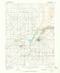
1962 Map of Delta
USGS Topo · Published 1965About this map
Union Pacific Railroad tracks bisect the high desert landscape of central Utah, anchoring the agricultural settlements of Delta, Hinckley, and Oasis. The intricate network of irrigation channels, including the Highline Ditch, Melville Ditch, and Abraham Canal, reveals a decades-long effort to divert the Sevier River and its Old Channel to support local ranching and farming. Historical sites of interest include the Ft Deseret (Ruins) and several scattered cemeteries near Sutherland and Deseret. This mid-century survey also notes the transition from traditional commerce to modern aviation, with the Delta Municipal Airport and an Airway Beacon positioned north of town. The Gunnison Bend Reservoir serves as a central hydrological feature, managing the flow that sustains the surrounding valley.
Find a feature on this map
55 named features on this map. Tap any name to fly to it.
Don’t see what you’re looking for? This feature index may not catch every label — zoom into the map to look around manually.
Map Details
Editions of this 1962 Delta Map
3 editions found
Other maps of this area

1885 · Sevier Desert
USGS Topo · 1:250,000

1951 · Oak City
USGS Topo · 1:62,500

1953 · Delta
USGS Topo · 1:250,000

1958 · Delta
USGS Topo · 1:250,000

1962 · Delta
USGS Topo · 1:250,000

1962 · Lynndyl
USGS Topo · 1:62,500

1962 · Holden
USGS Topo · 1:62,500

1962 · Delta
USGS Topo · 1:62,500

1971 · Smelter Knolls East
USGS Topo · 1:24,000

1971 · Baker Hot Springs
USGS Topo · 1:24,000