
1948 Map of Deltaville
USGS Topo · Published 1948About this map
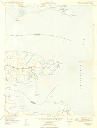
Deltaville sits at the heart of the Middlesex County peninsula in the late 1940s, a point where the maritime culture of the Chesapeake Bay meets the inland reaches of the Rappahannock River and Piankatank River. The landscape is defined by its intricate shoreline, where deep inlets like Broad Creek and Sturgeon Creek provided essential harbor for the regional fishing and oyster industries. Settlements such as Amburg, Ruark, and Grinels are clustered along the narrow roads that trace the high ground between these creeks. To the north, Fleets Island and Windmill Point guard the mouth of the Rappahannock, while the southern edge of the sheet captures the northern tip of Gwynn Island and the village of Grimstead. Several navigational aids, including Stingray Point LH and Jackson Creek Lt, highlight the area's significance as a coastal transit hub.
Find a feature on this map
55 named features on this map. Tap any name to fly to it.
Don’t see what you’re looking for? This feature index may not catch every label — zoom into the map to look around manually.
Map Details
Editions of this 1948 Deltaville Map
2 editions found
Other maps of this area

1916 · Kilmarnock
USGS Topo · 1:48,000

1916 · Mathews
USGS Topo · 1:62,500

1917 · Kilmarnock
USGS Topo · 1:62,500

1917 · Mathews
USGS Topo · 1:62,500

1942 · Kilmarnock
USGS Topo · 1:62,500

1943 · Richmond
USGS Topo · 1:250,000

1948 · Ware Neck
USGS Topo · 1:24,000

1948 · Mathews
USGS Topo · 1:24,000
1949 · Irvington
USGS Topo · 1:24,000
1949 · Fleets Bay
USGS Topo · 1:24,000