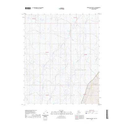
2023 Map of Demarcation Point C-4 NE
USGS Topo · Published 2023About this map
The Arctic National Wildlife Refuge encompasses this remote stretch of the North Slope, where the drainage systems of the Angun River and Kogotpak River carve through a landscape of wetlands and tundra. To the southeast, the protected expanse of the Mollie Beattie Wilderness begins to rise toward the mountains, bounded by the braided channels of the Aichilik River. This 2023 edition documents the pristine hydrography of the region before any modern road infrastructure has reached this far north. The map provides a critical record of Arctic water patterns, showing how these river systems navigate the coastal plain towards the Beaufort Sea. It serves as a detailed baseline for studying the shifting hydrology and natural boundaries of one of the nation's most significant conservation areas.
Find a feature on this map
11 named features on this map. Tap any name to fly to it.
Don’t see what you’re looking for? This feature index may not catch every label — zoom into the map to look around manually.
Map Details
Editions of this 2023 Demarcation Point C-4 NE Map
This is the sole edition of this map. No revisions or reprints were ever made.
Other maps of this area

1951 · Demarcation Point
USGS Topo · 1:250,000

1955 · Demarcation Point
USGS Topo · 1:250,000

1955 · Demarcation Point D-3
USGS Topo · 1:63,360

1955 · Demarcation Point C-4
USGS Topo · 1:63,360

1955 · Demarcation Point D-4
USGS Topo · 1:63,360

1955 · Demarcation Point C-3
USGS Topo · 1:63,360

1962 · Demarcation Point D-3
USGS Topo · 1:50,000

1964 · Demarcation Point
USGS Topo · 1:250,000
2018 · Demarcation Point C-4 SW
USGS Topo · 1:25,000
2018 · Demarcation Point D-4 SW
USGS Topo · 1:25,000