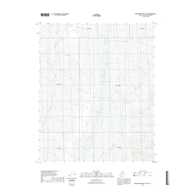
2018 Map of Demarcation Point C-5 NW
USGS Topo · Published 2018About this map
Akutoktak River and the braided channels of the Okpilak River dominate this high-latitude terrain within the North Slope Borough. This 2018 survey documents a landscape of coastal plain and glacial outwash, where water systems are the primary defining features across the Public Land Survey System townships of t5n r33e, t4n r33e, and t3n r34e. The presence of the Okpirourak Creek in the eastern portion of the quadrangle illustrates the intricate drainage patterns characteristic of this Arctic environment. Without roads or permanent settlements, the map focuses on the precise hydrology and topographic shifts that guide travel and survival in this undeveloped territory.
Find a feature on this map
9 named features on this map. Tap any name to fly to it.
Don’t see what you’re looking for? This feature index may not catch every label — zoom into the map to look around manually.
Map Details
Editions of this 2018 Demarcation Point C-5 NW Map
This is the sole edition of this map. No revisions or reprints were ever made.
Other maps of this area

1951 · Demarcation Point
USGS Topo · 1:250,000

1951 · Mt. Michelson
USGS Topo · 1:250,000

1955 · Demarcation Point
USGS Topo · 1:250,000

1955 · Mount Michelson C-1
USGS Topo · 1:63,360

1955 · Demarcation Point C-5
USGS Topo · 1:63,360

1955 · Mount Michelson D-1
USGS Topo · 1:63,360

1955 · Demarcation Point D-5
USGS Topo · 1:63,360

1956 · Mt. Michelson
USGS Topo · 1:250,000
1962 · Mt. Michelson D-1
USGS Topo · 1:50,000

1964 · Demarcation Point
USGS Topo · 1:250,000