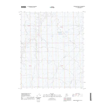
2023 Map of Demarcation Point D-4 SE
USGS Topo · Published 2023About this map
The Arctic National Wildlife Refuge dominates this section of the North Slope, revealing a landscape defined by the shifting braids of Arctic waterways. The Niguanak River flows through the western portion of the quadrangle, while the Sikrelurak River and Angun River traverse the central and eastern sections, respectively. These rivers navigate a vast expanse of wetlands, where the intricate drainage patterns suggest a complex hydrology characteristic of the coastal plain. The absence of roads or permanent structures underscores the remote and protected nature of this environment, preserving a snapshot of the region's natural state as it was documented in the early twenty-first century.
Find a feature on this map
8 named features on this map. Tap any name to fly to it.
Don’t see what you’re looking for? This feature index may not catch every label — zoom into the map to look around manually.
Map Details
Editions of this 2023 Demarcation Point D-4 SE Map
This is the sole edition of this map. No revisions or reprints were ever made.
Other maps of this area

1951 · Demarcation Point
USGS Topo · 1:250,000

1955 · Demarcation Point
USGS Topo · 1:250,000

1955 · Demarcation Point D-3
USGS Topo · 1:63,360

1955 · Demarcation Point C-4
USGS Topo · 1:63,360

1955 · Demarcation Point D-4
USGS Topo · 1:63,360

1955 · Demarcation Point C-3
USGS Topo · 1:63,360

1962 · Demarcation Point D-3
USGS Topo · 1:50,000

1964 · Demarcation Point
USGS Topo · 1:250,000
2018 · Demarcation Point D-4 NW
USGS Topo · 1:25,000
2018 · Demarcation Point D-4 SW
USGS Topo · 1:25,000