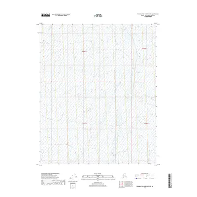
2018 Map of Demarcation Point D-5 SW
USGS Topo · Published 2018About this map
The Okpilak River and the Akutoktak River define this stretch of the North Slope, flowing northward through a landscape of intricate wetland patterns and braided stream channels. This survey, compiled from imagery and elevation data from the early 21st century, illustrates the complex hydrography of the Alaskan Arctic coastal plain. The absence of roads or permanent structures within the boundaries of t6n r33e and t5n r34e highlights the extreme isolation of this terrain. For researchers, the map provides a precise record of river migration and drainage networks prior to significant environmental shifts, documenting a wilderness shaped entirely by natural forces and seasonal cycles.
Find a feature on this map
6 named features on this map. Tap any name to fly to it.
Don’t see what you’re looking for? This feature index may not catch every label — zoom into the map to look around manually.
Map Details
Editions of this 2018 Demarcation Point D-5 SW Map
This is the sole edition of this map. No revisions or reprints were ever made.
Other maps of this area

1951 · Demarcation Point
USGS Topo · 1:250,000

1951 · Mt. Michelson
USGS Topo · 1:250,000

1955 · Demarcation Point
USGS Topo · 1:250,000

1955 · Mount Michelson C-1
USGS Topo · 1:63,360

1955 · Demarcation Point C-5
USGS Topo · 1:63,360

1955 · Mount Michelson D-1
USGS Topo · 1:63,360

1955 · Demarcation Point D-5
USGS Topo · 1:63,360

1956 · Mt. Michelson
USGS Topo · 1:250,000
1962 · Mt. Michelson D-1
USGS Topo · 1:50,000

1964 · Demarcation Point
USGS Topo · 1:250,000