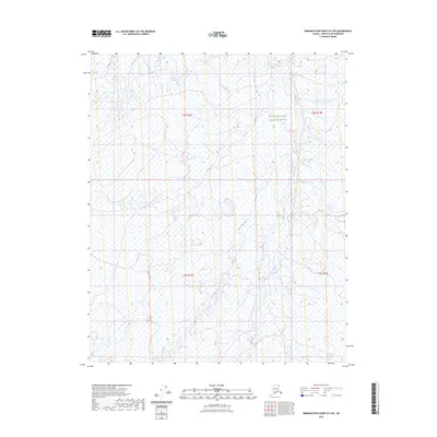
2023 Map of Demarcation Point D-5 SW
USGS Topo · Published 2023About this map
The Arctic National Wildlife Refuge dominates this northern Alaskan landscape, where the braided channels of the Okpilak River and Akutoktak River wind through the North Slope toward the Beaufort Sea. The terrain is characterized by complex hydrology and wetland patterns typical of the Arctic coastal plain, providing a look at a landscape defined by seasonal water flow and lack of permanent human infrastructure. The presence of the Arctic National Wildlife Refuge designation across these townships underscores the region's status as a protected wilderness area. This modern survey maps the shifting riparian corridors of the Akutoktak River and the eastern boundary formed by the Okpilak River with high-precision contouring.
Find a feature on this map
7 named features on this map. Tap any name to fly to it.
Don’t see what you’re looking for? This feature index may not catch every label — zoom into the map to look around manually.
Map Details
Editions of this 2023 Demarcation Point D-5 SW Map
This is the sole edition of this map. No revisions or reprints were ever made.
Other maps of this area

1951 · Demarcation Point
USGS Topo · 1:250,000

1951 · Mt. Michelson
USGS Topo · 1:250,000

1955 · Demarcation Point
USGS Topo · 1:250,000

1955 · Mount Michelson C-1
USGS Topo · 1:63,360

1955 · Demarcation Point C-5
USGS Topo · 1:63,360

1955 · Mount Michelson D-1
USGS Topo · 1:63,360

1955 · Demarcation Point D-5
USGS Topo · 1:63,360

1956 · Mt. Michelson
USGS Topo · 1:250,000
1962 · Mt. Michelson D-1
USGS Topo · 1:50,000

1964 · Demarcation Point
USGS Topo · 1:250,000