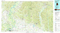
1990 Map of Demopolis
USGS Topo · Published 1990About this map
The confluence of the Black Warrior River and Tombigbee River anchors this regional landscape, where the flatlands of the Black Belt meet the ridges of the Talladega National Forest. In Demopolis, the presence of the Demopolis Lock and Dam and a powerplant illustrates the late 20th-century industrial reliance on these waterways. Educational and civic life is centered in Marion, featuring the historic Marion Military Institute and Judson College, alongside the Marion National Fish Hatchery.
Find a feature on this map
139 named features on this map. Tap any name to fly to it.
Don’t see what you’re looking for? This feature index may not catch every label — zoom into the map to look around manually.
Map Details
Editions of this 1990 Demopolis Map
This is the sole edition of this map. No revisions or reprints were ever made.
Other maps of this area

1890 · Bessemer
USGS Topo · 1:125,000

1891 · Clanton
USGS Topo · 1:125,000

1892 · Bessemer
USGS Topo · 1:125,000

1899 · Brookwood
USGS Topo · 1:125,000

1910 · Montevallo
USGS Topo · 1:62,500

1924 · Tuscaloosa
USGS Topo · 1:62,500

1926 · Tuscaloosa
USGS Topo · 1:62,500

1927 · Eutaw
USGS Topo · 1:48,000

1929 · Epes
USGS Topo · 1:48,000

1931 · Cottondale
USGS Topo · 1:48,000