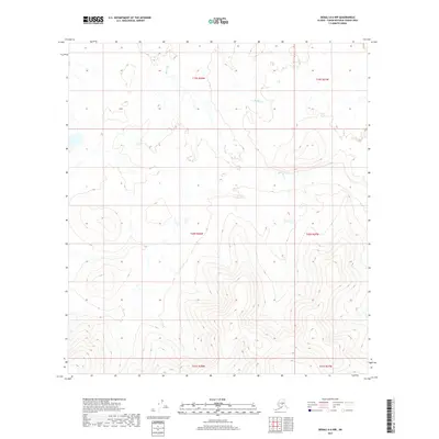
2017 Map of Denali A-6 NW
USGS Topo · Published 2017About this map
Slow Fork and Middle Creek define the drainage patterns across this interior Alaskan landscape, which transitions from low-lying wetlands in the north to increasingly prominent mountain ridges in the south. The northern reaches within t19s r28w and t19s r27w are characterized by the meandering path of the Slow Fork, suggesting a region of broad valleys and slower-moving water. As one moves south through t20s r28w and t20s r27w, the topographic contouring becomes significantly denser, marking the ascent into the higher elevations of the Alaska Range foothills. This map provides a precise look at the land's natural geometry in the Yukon-Koyukuk Census Area, illustrating how the glacial or tectonic features of the terrain dictate the flow of its northern interior waterways.
Find a feature on this map
8 named features on this map. Tap any name to fly to it.
Don’t see what you’re looking for? This feature index may not catch every label — zoom into the map to look around manually.
Map Details
Editions of this 2017 Denali A-6 NW Map
This is the sole edition of this map. No revisions or reprints were ever made.
Other maps of this area

1950 · Medfra
USGS Topo · 1:250,000

1952 · Mount McKinley
USGS Topo · 1:250,000

1958 · Medfra A-1
USGS Topo · 1:63,360

1958 · Mount McKinley B-6
USGS Topo · 1:63,360

1958 · Mount McKinley A-6
USGS Topo · 1:63,360

1958 · Mount McKinley
USGS Topo · 1:250,000

1958 · Medfra B-1
USGS Topo · 1:63,360

1959 · Medfra
USGS Topo · 1:250,000

1969 · Mount McKinley
USGS Topo · 1:250,000
2017 · Denali B-6 SW
USGS Topo · 1:25,000