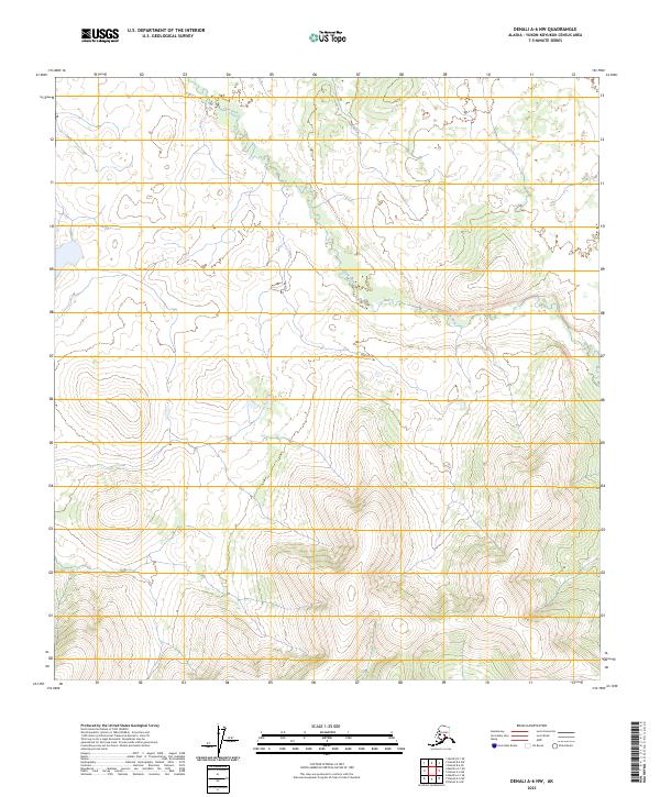
2023 Map of Denali A-6 NW
USGS Topo · Published 2023About this map
Slow Fork and Middle Creek drain a high-elevation landscape in the interior of Alaska, where the terrain transitions from low-lying wetland basins to steep mountainous ridges. This 2023 survey delineates the complex hydrological patterns of the region, showing how the Slow Fork meanders through the northern sections before the elevation rises sharply toward the south. The absence of roads or established settlements emphasizes the remote, undisturbed character of this wilderness area. Topographic contours reveal a series of prominent peaks and valleys that define the watershed boundaries, providing a clear view of the natural drainage systems that feed into the larger river networks of the Yukon-Koyukuk Census Area.
Find a feature on this map
8 named features on this map. Tap any name to fly to it.
Don’t see what you’re looking for? This feature index may not catch every label — zoom into the map to look around manually.
Map Details
Editions of this 2023 Denali A-6 NW Map
This is the sole edition of this map. No revisions or reprints were ever made.
Other maps of this area

1950 · Medfra
USGS Topo · 1:250,000

1952 · Mount McKinley
USGS Topo · 1:250,000

1958 · Medfra A-1
USGS Topo · 1:63,360

1958 · Mount McKinley B-6
USGS Topo · 1:63,360

1958 · Mount McKinley A-6
USGS Topo · 1:63,360

1958 · Mount McKinley
USGS Topo · 1:250,000

1958 · Medfra B-1
USGS Topo · 1:63,360

1959 · Medfra
USGS Topo · 1:250,000

1969 · Mount McKinley
USGS Topo · 1:250,000
2017 · Denali B-6 SW
USGS Topo · 1:25,000