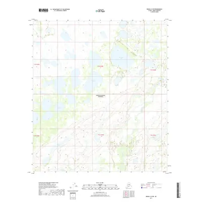
2017 Map of Denali C-5 SW
USGS Topo · Published 2017About this map
Denali National Preserve encompasses a significant portion of this interior Alaskan landscape, characterized by a complex network of wetlands and namesake water bodies. The terrain is defined by low-lying drainages where the Herron River meanders across the eastern half of the quadrangle. A dense concentration of lakes, including the uniquely shaped Spectacle Lake and the prominently named Old Cache Lake, suggests a landscape shaped by glacial activity and permafrost dynamics. These water bodies, such as Caribou Lake and Big Long Lake, likely served as critical landmarks for seasonal subsistence and travel in a region largely devoid of established road infrastructure. The map illustrates the wilderness character of the western Alaska Range foothills, capturing the intricate hydrography that defines this remote subarctic environment.
Find a feature on this map
14 named features on this map. Tap any name to fly to it.
Don’t see what you’re looking for? This feature index may not catch every label — zoom into the map to look around manually.
Map Details
Editions of this 2017 Denali C-5 SW Map
This is the sole edition of this map. No revisions or reprints were ever made.
Other maps of this area

1952 · Mount McKinley
USGS Topo · 1:250,000

1953 · Mount McKinley C-5
USGS Topo · 1:63,360

1953 · Mount McKinley B-5
USGS Topo · 1:63,360

1954 · Mount McKinley B-5
USGS Topo · 1:63,360

1954 · Mount McKinley C-5
USGS Topo · 1:63,360

1958 · Mount McKinley B-6
USGS Topo · 1:63,360

1958 · Mount McKinley C-6
USGS Topo · 1:63,360

1958 · Mount McKinley
USGS Topo · 1:250,000

1969 · Mount McKinley
USGS Topo · 1:250,000
2017 · Denali C-5 SE
USGS Topo · 1:25,000