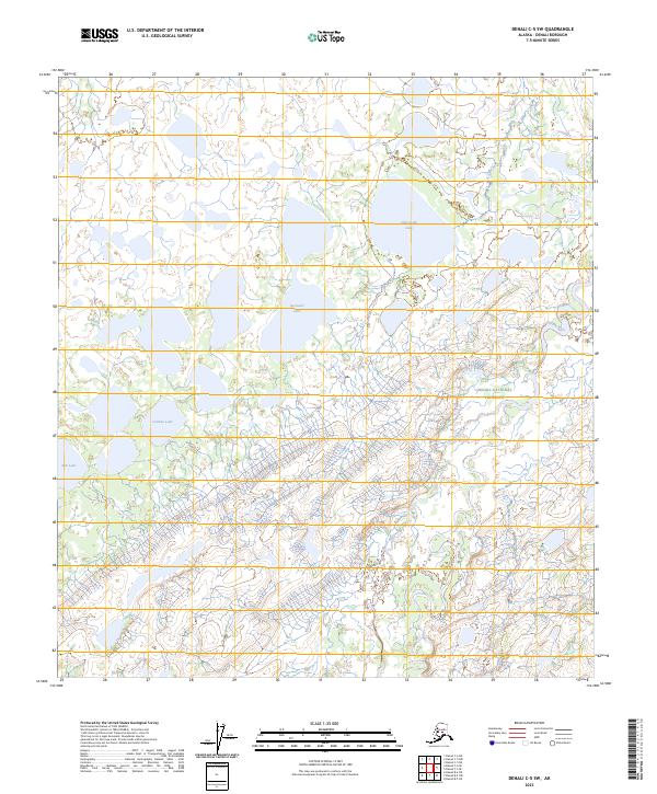
2023 Map of Denali C-5 SW
USGS Topo · Published 2023About this map
Denali National Preserve encompasses the southeastern portion of this landscape, where the braided channels of the Herron River descend from higher elevations toward the low-lying wetlands of the north. This terrain is defined by a dense network of glacial lakes and pond complexes, including the sizable Old Cache Lake and the distinctively shaped Spectacle Lake. The abundance of water bodies such as Caribou Lake and Fish Lake indicates a territory largely shaped by hydraulic processes rather than permanent human infrastructure. The absence of roads or named settlements reflects the protected and primitive character of this part of the Alaska interior, where the primary geographical markers are those of the natural drainage systems and established wilderness boundaries.
Find a feature on this map
12 named features on this map. Tap any name to fly to it.
Don’t see what you’re looking for? This feature index may not catch every label — zoom into the map to look around manually.
Map Details
Editions of this 2023 Denali C-5 SW Map
This is the sole edition of this map. No revisions or reprints were ever made.
Other maps of this area

1952 · Mount McKinley
USGS Topo · 1:250,000

1953 · Mount McKinley C-5
USGS Topo · 1:63,360

1953 · Mount McKinley B-5
USGS Topo · 1:63,360

1954 · Mount McKinley B-5
USGS Topo · 1:63,360

1954 · Mount McKinley C-5
USGS Topo · 1:63,360

1958 · Mount McKinley B-6
USGS Topo · 1:63,360

1958 · Mount McKinley C-6
USGS Topo · 1:63,360

1958 · Mount McKinley
USGS Topo · 1:250,000

1969 · Mount McKinley
USGS Topo · 1:250,000
2017 · Denali C-5 SE
USGS Topo · 1:25,000