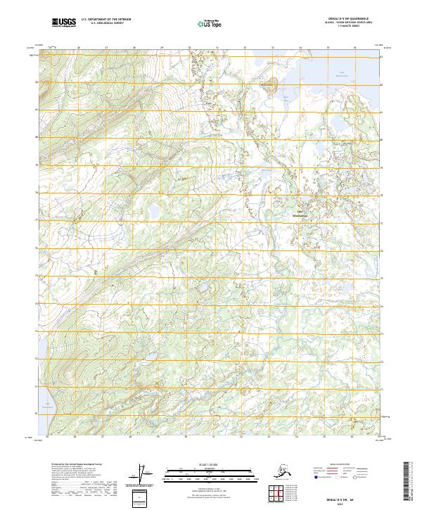
2023 Map of Denali D-5 SW
USGS Topo · Published 2023About this map
Lake Minchumina dominates the northeastern corner of this interior Alaskan landscape, where the water meets the shore at Giles Bay. This 2023 survey by the U.S. Geological Survey details a region defined by intricate drainage patterns and low-lying wetlands typical of the Yukon-Koyukuk Census Area. To the south, the topography rises into the Shislo'so Hills, providing a distinct contrast to the lake-dotted flats of the north. Smaller bodies of water like Slim Lake and the more distant Lake Snohomish are connected by a network of seasonal and permanent waterways, including Parker Creek and Donchelok Creek. The presence of Moose Island within the larger lake basin highlights the complex shoreline and hydrological character of this remote subarctic environment.
Find a feature on this map
15 named features on this map. Tap any name to fly to it.
Don’t see what you’re looking for? This feature index may not catch every label — zoom into the map to look around manually.
Map Details
Editions of this 2023 Denali D-5 SW Map
This is the sole edition of this map. No revisions or reprints were ever made.
Other maps of this area

1952 · Mount McKinley
USGS Topo · 1:250,000

1953 · Mount McKinley C-5
USGS Topo · 1:63,360

1953 · Mount McKinley D-5
USGS Topo · 1:63,360

1954 · Mount McKinley D-5
USGS Topo · 1:63,360

1954 · Mount McKinley C-5
USGS Topo · 1:63,360

1958 · Mount McKinley D-6
USGS Topo · 1:63,360

1958 · Mount McKinley C-6
USGS Topo · 1:63,360

1958 · Mount McKinley
USGS Topo · 1:250,000

1969 · Mount McKinley
USGS Topo · 1:250,000
2017 · Denali D-5 SW
USGS Topo · 1:25,000