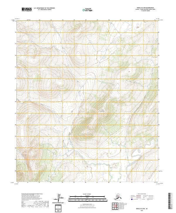
2023 Map of Denali D-6 NW
USGS Topo · Published 2023About this map
Sischu Mountains dominate the central landscape of this interior Alaskan quadrangle, providing a rugged vertical contrast to the drainage basins that define the surrounding terrain. In the southern reach of the map, the North Fork Kuskokwim River meanders toward the southwest, its course flanked by the rising elevation of Munsatli Ridge. This area, characterized by its isolation and lack of developed infrastructure, is primarily shaped by the hydrology of Lynx Creek, which cuts through the mountainous terrain. The map provides a precise record of the Public Land Survey System grid, including boundaries for t11s r27w and t12s r28w, illustrating how these remote townships are partitioned across the Alaskan wilderness.
Find a feature on this map
10 named features on this map. Tap any name to fly to it.
Don’t see what you’re looking for? This feature index may not catch every label — zoom into the map to look around manually.
Map Details
Editions of this 2023 Denali D-6 NW Map
This is the sole edition of this map. No revisions or reprints were ever made.
Other maps of this area

1948 · Kantishna River
USGS Topo · 1:250,000

1950 · Medfra
USGS Topo · 1:250,000

1951 · Kantishna River
USGS Topo · 1:250,000

1951 · Ruby
USGS Topo · 1:250,000

1952 · Mount McKinley
USGS Topo · 1:250,000

1952 · Ruby A-1
USGS Topo · 1:63,360

1952 · Kantishna River
USGS Topo · 1:250,000

1952 · Kantishna River A-6
USGS Topo · 1:63,360

1952 · Ruby
USGS Topo · 1:250,000
1953 · Kantishna River A-6
USGS Topo · 1:63,360