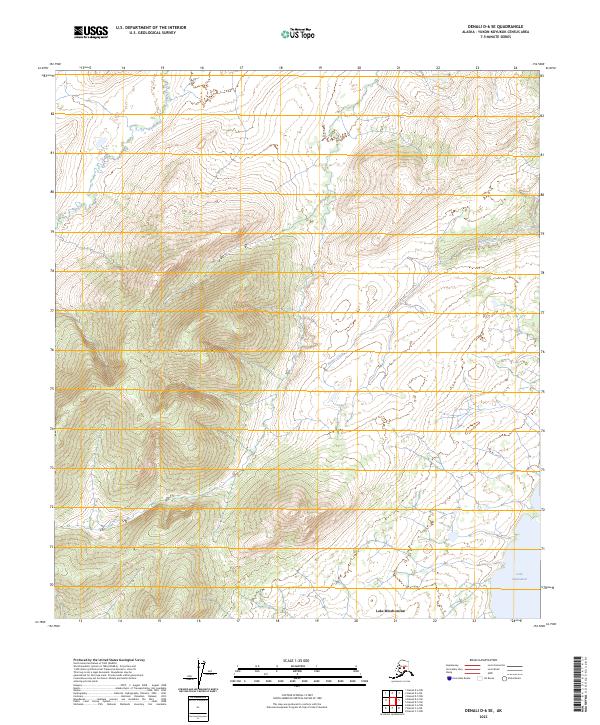
2023 Map of Denali D-6 SE
USGS Topo · Published 2023About this map
Snohomish Hills dominate the central-western portion of this Interior Alaska landscape, rising above a network of glacial waterways and wetlands. The topography is defined by the proximity of Lake Minchumina in the south and the smaller Lake Snohomish to the east. These large bodies of water, along with the meandering paths of Fish Creek and Parker Creek, illustrate the complex drainage patterns typical of the region. The map provides a look at the township and range survey lines (T12S, T13S) across the Yukon-Koyukuk Census Area, showing how the land is formally partitioned even in areas with minimal infrastructure. The landscape's character is one of transition between the elevated hills and the lower riparian basins that fed local water systems.
Find a feature on this map
10 named features on this map. Tap any name to fly to it.
Don’t see what you’re looking for? This feature index may not catch every label — zoom into the map to look around manually.
Map Details
Editions of this 2023 Denali D-6 SE Map
This is the sole edition of this map. No revisions or reprints were ever made.
Other maps of this area

1952 · Mount McKinley
USGS Topo · 1:250,000

1953 · Mount McKinley C-5
USGS Topo · 1:63,360

1953 · Mount McKinley D-5
USGS Topo · 1:63,360

1954 · Mount McKinley D-5
USGS Topo · 1:63,360

1954 · Mount McKinley C-5
USGS Topo · 1:63,360

1958 · Mount McKinley D-6
USGS Topo · 1:63,360

1958 · Mount McKinley C-6
USGS Topo · 1:63,360

1958 · Mount McKinley
USGS Topo · 1:250,000

1969 · Mount McKinley
USGS Topo · 1:250,000
2017 · Denali D-5 SW
USGS Topo · 1:25,000