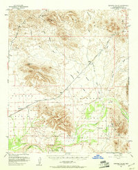
1951 Map of Dendora Valley
USGS Topo · Published 1961About this map
Oatman Flat serves as a focal point for history along the Gila River in this 1951 survey of the Maricopa desert. The map documents significant local landmarks including the Oatman Grave and Furr Grave, providing essential data for genealogists and historians of the Arizona frontier. To the north and west, the arid expanse of the Palomas Plain and the Dendora Valley are defined by intermittent water sources like Yellow Medicine Tank and Quail Spring Wash.
Find a feature on this map
29 named features on this map. Tap any name to fly to it.
Don’t see what you’re looking for? This feature index may not catch every label — zoom into the map to look around manually.
Map Details
Editions of this 1951 Dendora Valley Map
3 editions found
Other maps of this area

1927 · Hyder
USGS Topo · 1:62,500

1929 · Aztec
USGS Topo · 1:62,500

1930 · Hyder
USGS Topo · 1:62,500

1942 · Vicksburg
USGS Topo · 1:250,000

1949 · Sentinel
USGS Topo · 1:62,500

1950 · Sentinel
USGS Topo · 1:62,500

1950 · Theba
USGS Topo · 1:62,500

1950 · Aztec
USGS Topo · 1:62,500

1951 · Theba
USGS Topo · 1:62,500

1951 · Dendora Valley
USGS Topo · 1:62,500