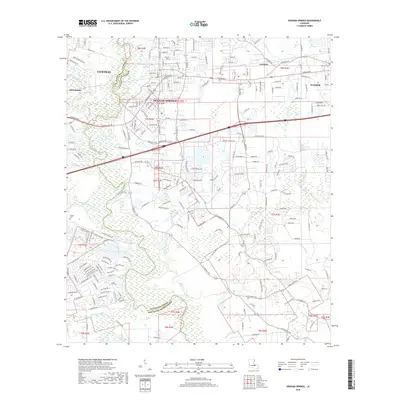
2018 Map of Denham Springs
USGS Topo · Published 2018About this map
Denham Springs serves as the focal point of this 2018 survey, situated where the Amite River and Comite River define the boundary between East Baton Rouge Parish and Livingston Parish. The landscape is defined by its intricate hydrography, featuring numerous slow-moving water bodies such as Clay-Cut Bayou, Honey Cut Bayou, and Sandy Bayou. The map illustrates the suburban expansion and modern road networks extending from Central in the west to Walker in the east.
Find a feature on this map
223 named features on this map. Tap any name to fly to it.
Don’t see what you’re looking for? This feature index may not catch every label — zoom into the map to look around manually.
Map Details
Editions of this 2018 Denham Springs Map
This is the sole edition of this map. No revisions or reprints were ever made.
Other maps of this area

1906 · Bayou Sara
USGS Topo · 1:125,000

1908 · Baton Rouge
USGS Topo · 1:62,500

1934 · Denham Springs
USGS Topo · 1:62,500

1939 · Zachary
USGS Topo · 1:62,500

1939 · Denham Springs
USGS Topo · 1:62,500

1939 · Baton Rouge
USGS Topo · 1:62,500

1942 · Watson
USGS Topo · 1:31,680

1942 · Satsuma
USGS Topo · 1:31,680

1953 · Walker
USGS Topo · 1:24,000

1953 · St. Gabriel
USGS Topo · 1:24,000