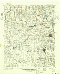
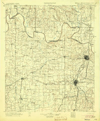
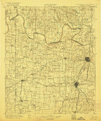
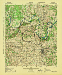
1901 Map of Denison
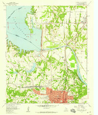
USGS Topo · Published 1949About this map
The Red River defines the winding boundary between the Chickasaw Nation of Indian Territory and North Texas at the turn of the century. This landscape is a dense network of river-crossing infrastructure, where Delaware Ferry, Willis Ferry, and the Colbert Bridge connect scattered settlements such as Woodyville and Pickwick. The map reveals the critical importance of early rail hubs, with Denison and Sherman serving as major junctions for the Houston and Texas Central R. R. and the St. Louis and San Francisco R. R.. Beyond the industrial rail corridors, the terrain transitions into a more rural character marked by features like Brushy Mound and small communities like Basin Springs and Gordonville, offering a detailed view of the region’s development before the creation of modern reservoirs.
Find a feature on this map
106 named features on this map. Tap any name to fly to it.
Don’t see what you’re looking for? This feature index may not catch every label — zoom into the map to look around manually.
Map Details
Editions of this 1901 Denison Map
4 editions found
Other maps of this area

1899 · Atoka
USGS Topo · 1:125,000

1900 · Atoka
USGS Topo · 1:125,000

1901 · Tishomingo
USGS Topo · 1:125,000

1901 · Ardmore
USGS Topo · 1:125,000

1901 · Denison
USGS Topo · 1:125,000

1902 · Gainesville
USGS Topo · 1:125,000

1918 · Ardmore
USGS Topo · 1:125,000
1943 · Gainesville
USGS Topo · 1:125,000

1954 · Sherman
USGS Topo · 1:250,000
1957 · Denison Dam
USGS Topo · 1:24,000