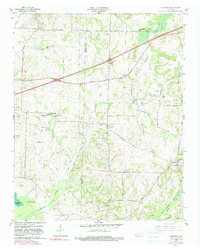
1959 Map of Denmark
USGS Topo · Published 1990About this map
Denmark and the surrounding agricultural landscape of western Madison County are documented here as they appeared mid-century. The terrain is defined by a dense network of small family-named cemeteries and rural institutions, including Bond Cemetery, Union Cem, and St Johns Ch, reflecting the deep-rooted community structure of the era. The land is drained by numerous winding waterways like Cypress Creek and Browns Creek, which dictated the early placement of schools such as Woodland Sch and Browns Creek Sch.
Find a feature on this map
47 named features on this map. Tap any name to fly to it.
Don’t see what you’re looking for? This feature index may not catch every label — zoom into the map to look around manually.
Map Details
Editions of this 1959 Denmark Map
3 editions found
Other maps of this area

1950 · Sunnyhill
USGS Topo · 1:24,000

1951 · Sunnyhill
USGS Topo · 1:24,000

1956 · Blytheville
USGS Topo · 1:250,000

1959 · Blytheville
USGS Topo · 1:250,000

1959 · Bells
USGS Topo · 1:24,000

1959 · Westover
USGS Topo · 1:24,000

1959 · Denmark
USGS Topo · 1:24,000

1959 · Adair
USGS Topo · 1:24,000

1959 · Hillville
USGS Topo · 1:24,000

1961 · Jones
USGS Topo · 1:24,000