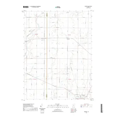
2019 Map of Denmark
USGS Topo · Published 2019About this map
The Olentangy River and Whetstone Creek carve through this central Ohio landscape, marking the transition between the agricultural plains of Marion and Morrow counties. The area is defined by a dense network of small burial grounds and rural crossroads, with the Marion Co Morrow Co boundary line bisecting the region north-to-south. Settlement hubs like Claridon and the village of Denmark anchor the local road system, while the larger town of Cardington sits in the southeast corner. Genealogists will find a wealth of named sites, including Graveyard Hill, Thew Cem, and the Underwood Cem. The land is heavily drained by a series of agricultural channels such as Muskrat Ditch, McKibben Ditch, and Buehrmond Ditch, which support the farmstead economy that has shaped this region for generations.
Find a feature on this map
107 named features on this map. Tap any name to fly to it.
Don’t see what you’re looking for? This feature index may not catch every label — zoom into the map to look around manually.
Map Details
Editions of this 2019 Denmark Map
This is the sole edition of this map. No revisions or reprints were ever made.
Other maps of this area

1903 · Marion
USGS Topo · 1:62,500

1905 · Marion
USGS Topo · 1:62,500

1913 · Mount Gilead
USGS Topo · 1:62,500

1915 · Marengo
USGS Topo · 1:62,500

1916 · Mount Gilead
USGS Topo · 1:62,500

1924 · Delaware
USGS Topo · 1:62,500

1925 · Delaware
USGS Topo · 1:62,500

1943 · Marengo
USGS Topo · 1:62,500

1943 · Mount Gilead
USGS Topo · 1:62,500

1944 · Delaware
USGS Topo · 1:62,500