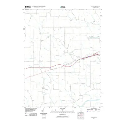
2010 Map of Dennison
USGS Topo · Published 2010About this map
The Wabash River serves as the dominant natural boundary in this landscape of southern Clark County, Illinois, as it appeared in the early 21st century. The map centers on the area around Dennison Post Office, where agricultural patterns are defined by a network of drainage systems including Sugar Creek, Clear Creek, and Hawks Creek. Local family history is well-preserved through several small burial grounds such as Dennison Cemetery, Farris Cemetery, and Black Cemetery, which offer valuable coordinates for genealogists tracing regional lineages.
Find a feature on this map
52 named features on this map. Tap any name to fly to it.
Don’t see what you’re looking for? This feature index may not catch every label — zoom into the map to look around manually.
Map Details
Editions of this 2010 Dennison Map
This is the sole edition of this map. No revisions or reprints were ever made.
Other maps of this area

1932 · Marshall
USGS Topo · 1:62,500

1937 · Marshall
USGS Topo · 1:62,500

1940 · Pimento
USGS Topo · 1:24,000

1941 · Terre Haute
USGS Topo · 1:24,000

1942 · Hutton
USGS Topo · 1:24,000

1942 · Dennison
USGS Topo · 1:24,000

1947 · Paris
USGS Topo · 1:62,500

1948 · Terre Haute
USGS Topo · 1:24,000

1949 · Paris
USGS Topo · 1:62,500

1950 · New Goshen
USGS Topo · 1:24,000