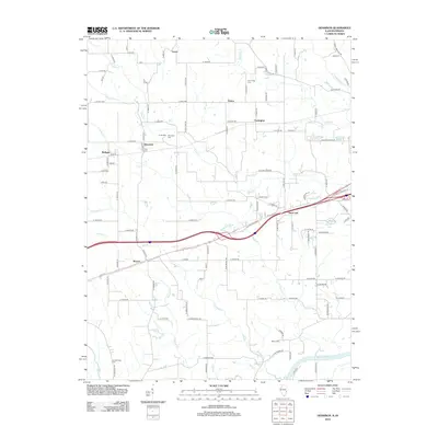
2012 Map of Dennison
USGS Topo · Published 2012About this map
Dennison and McKeen stand as central points in this landscape where the Illinois border meets Indiana. The terrain is defined by a dense network of watercourses, including Clear Cr, Hawks Cr, and Crooked Cr, which drain toward the Wabash River in the southeast. For genealogists, the map is particularly rich in burial sites such as Cumberland Cem and Farris Cem, while the settlement of State Line anchors the eastern edge of the quadrangle. The survey reveals a rural infrastructure of named country roads and small clusters of buildings at Ferrel and Patton, reflecting a long-standing agricultural pattern. Small bodies of water like Kieweg Lake and Windemere Lake are interspersed among the drainages, showing how local hydrology has been utilized for recreation or water management in this borderland corridor.
Find a feature on this map
114 named features on this map. Tap any name to fly to it.
Don’t see what you’re looking for? This feature index may not catch every label — zoom into the map to look around manually.
Map Details
Editions of this 2012 Dennison Map
This is the sole edition of this map. No revisions or reprints were ever made.
Other maps of this area

1932 · Marshall
USGS Topo · 1:62,500

1937 · Marshall
USGS Topo · 1:62,500

1940 · Pimento
USGS Topo · 1:24,000

1941 · Terre Haute
USGS Topo · 1:24,000

1942 · Hutton
USGS Topo · 1:24,000

1942 · Dennison
USGS Topo · 1:24,000

1947 · Paris
USGS Topo · 1:62,500

1948 · Terre Haute
USGS Topo · 1:24,000

1949 · Paris
USGS Topo · 1:62,500

1950 · New Goshen
USGS Topo · 1:24,000