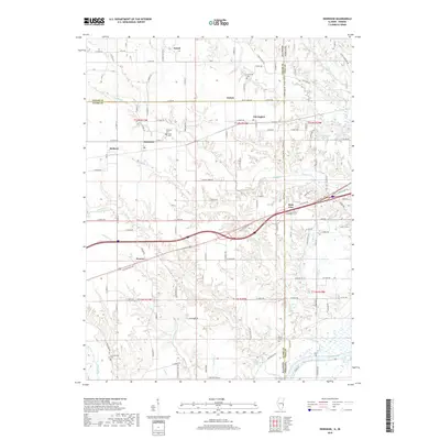
2018 Map of Dennison
USGS Topo · Published 2018About this map
Dennison and Weaver sit at the heart of this survey of the Illinois and Indiana borderlands, where the landscape is defined by the drainage systems of Sugar Creek and Crooked Creek. The terrain transitions from the upland settlements of Patton and McKeen in Clark County toward the low-lying wetlands of Chestnut Bayou along the Wabash River. Historical transportation routes are prominent, with the Old National Hwy and W National Ave cutting through the center of the sheet, providing a modern look at the path of the historic National Road. Genealogists will find a cluster of burial sites, including Dennison Cem, Farris Cem, and Cumberland Cem, which anchor the small rural communities and family homesteads that have persisted along the state line for generations.
Find a feature on this map
78 named features on this map. Tap any name to fly to it.
Don’t see what you’re looking for? This feature index may not catch every label — zoom into the map to look around manually.
Map Details
Editions of this 2018 Dennison Map
This is the sole edition of this map. No revisions or reprints were ever made.
Other maps of this area

1932 · Marshall
USGS Topo · 1:62,500

1937 · Marshall
USGS Topo · 1:62,500

1940 · Pimento
USGS Topo · 1:24,000

1941 · Terre Haute
USGS Topo · 1:24,000

1942 · Hutton
USGS Topo · 1:24,000

1942 · Dennison
USGS Topo · 1:24,000

1947 · Paris
USGS Topo · 1:62,500

1948 · Terre Haute
USGS Topo · 1:24,000

1949 · Paris
USGS Topo · 1:62,500

1950 · New Goshen
USGS Topo · 1:24,000