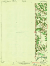
1942 Map of Dennison
USGS Topo · Published 1942About this map
The Wabash River forms a defining natural border along the eastern edge of this Illinois-Indiana survey, separating Clark County and Vigo County. The terrain transitions from the wooded bluffs and drainages of Sugar Creek and Clear Creek to the flat expanse of the Prairie in the southeast. This map captures a rural landscape dominated by a network of early named thoroughfares, including the historic National Road and the Paris Road, which served as vital connections for agricultural settlements before the era of modern interstate highways.
Find a feature on this map
21 named features on this map. Tap any name to fly to it.
Don’t see what you’re looking for? This feature index may not catch every label — zoom into the map to look around manually.
Map Details
Editions of this 1942 Dennison Map
2 editions found
Other maps of this area

1932 · Marshall
USGS Topo · 1:62,500

1937 · Marshall
USGS Topo · 1:62,500

1940 · Pimento
USGS Topo · 1:24,000

1941 · Terre Haute
USGS Topo · 1:24,000

1942 · Hutton
USGS Topo · 1:24,000

1942 · Dennison
USGS Topo · 1:24,000

1947 · Paris
USGS Topo · 1:62,500

1948 · Terre Haute
USGS Topo · 1:24,000

1949 · Paris
USGS Topo · 1:62,500

1950 · New Goshen
USGS Topo · 1:24,000