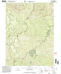
1998 Map of Denny
USGS Topo · Published 2003About this map
Denny stands as a focal point in this 1990s wilderness survey, situated near the confluence of New River and Quimby Creek within the Shasta-Trinity National Forest. The map documents a landscape defined by the intersection of forest service management and early mining history, particularly in the vicinity of McAtee Bar. Mining legacies are evident through the Index Mine and Hazel D Mine, while the presence of the Cem near Dailey provides a point of interest for genealogists tracing local families.
Find a feature on this map
38 named features on this map. Tap any name to fly to it.
Don’t see what you’re looking for? This feature index may not catch every label — zoom into the map to look around manually.
Map Details
Editions of this 1998 Denny Map
This is the sole edition of this map. No revisions or reprints were ever made.
Other maps of this area

1909 · Big Bar
USGS Topo · 1:96,000

1915 · Big Bar and Vicinity
USGS Topo · 1:250,000

1922 · China Flat
USGS Topo · 1:62,500

1925 · Hoopa
USGS Topo · 1:125,000

1948 · Weed
USGS Topo · 1:250,000

1950 · Weed
USGS Topo · 1:250,000

1951 · Ironside Mountain
USGS Topo · 1:62,500

1952 · Willow Creek
USGS Topo · 1:62,500

1952 · Hoopa
USGS Topo · 1:62,500

1955 · Salmon Mtn
USGS Topo · 1:62,500