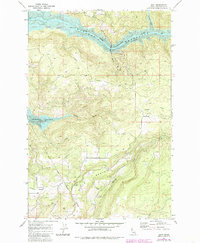
1969 Map of Dent
USGS Topo · Published 1985About this map
Wells Bench and the surrounding Clearwater County highlands are captured here during a period of significant landscape transformation. The northern portion of the map is dominated by the Dworshak Reservoir, a massive body of water created by the damming of the North Fork Clearwater River. This flooding altered the local geography, leaving the small settlement of Dent situated along the new shoreline near several campgrounds.
Find a feature on this map
22 named features on this map. Tap any name to fly to it.
Don’t see what you’re looking for? This feature index may not catch every label — zoom into the map to look around manually.
Map Details
Editions of this 1969 Dent Map
Other maps of this area

1924 · Kamiah
USGS Topo · 1:125,000

1955 · Pullman
USGS Topo · 1:250,000

1958 · Pullman
USGS Topo · 1:250,000

1961 · Ahsahka
USGS Topo · 1:62,500

1967 · Rudo
USGS Topo · 1:24,000

1967 · Orofino West
USGS Topo · 1:24,000

1967 · Orofino East
USGS Topo · 1:24,000

1969 · Elk Creek Falls
USGS Topo · 1:24,000
1969 · Grangemont
USGS Topo · 1:24,000
1969 · Dent
USGS Topo · 1:24,000