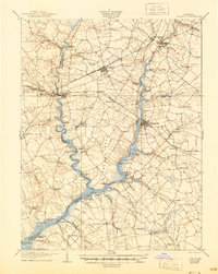
1905 Map of Denton
USGS Topo · Published 1945About this map
Denton serves as the focal point of this Maryland Eastern Shore landscape, situated where the Choptank River narrows and transitions into a network of vital waterways. The map illustrates a society deeply integrated with its riverine environment, marked by an extensive series of landings and wharves such as Passapae Landing, Smith Landing, and Todd Wharf. These points served the designated Steamboat Route, which provided essential commercial connectivity before the full dominance of overland rail. On land, the Queen Anne RR and the Chesapeake and Delaware RR intersect the terrain, linking small farming settlements like Ridely, Hillsboro, and Greensboro. The presence of Geary Millpond and Knott Millpond indicates the local importance of water-powered industry, while the naming of places like Two Johns and American Corner offers unique genealogical markers for researchers of Caroline and Queen Anne counties.
Find a feature on this map
74 named features on this map. Tap any name to fly to it.
Don’t see what you’re looking for? This feature index may not catch every label — zoom into the map to look around manually.
Map Details
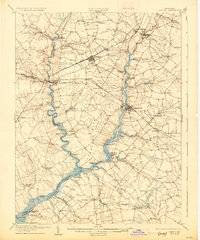
Editions of this 1905 Denton Map
3 editions found
Other maps of this area

1898 · Choptank
USGS Topo · 1:125,000

1898 · Tolchester
USGS Topo · 1:125,000

1899 · Dover
USGS Topo · 1:125,000

1901 · Chestertown
USGS Topo · 1:62,500

1903 · Tolchester
USGS Topo · 1:125,000

1904 · St. Michaels
USGS Topo · 1:62,500

1904 · Oxford
USGS Topo · 1:62,500

1905 · Denton
USGS Topo · 1:62,500

1905 · Barclay
USGS Topo · 1:62,500

1905 · Hurlock
USGS Topo · 1:62,500