2021 Map of Denton
USGS Topo · Published 2021About this map
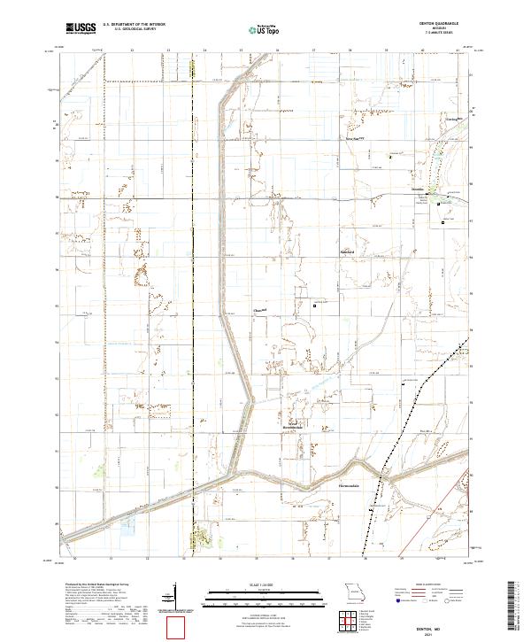
The Missouri Bootheel landscape shown here is defined by an intensive drainage network essential to the region's agricultural history. The Main Ditch and numerous secondary channels like Ditch Number 2 and Ditch Number 8 cross the terrain, revealing the engineering required to convert these lowlands into productive farmland. Small rural settlements and family-named landmarks are scattered throughout, including Denton and Hermondale. Genealogy researchers will find significant value in the distribution of local burial sites, from the Albert B Denton Family Cem and Barnard Cem in the northeast to the Macedonia Cem in the south. The western edge follows the Dunklin and Pemiscot county line, where natural features like the winding Pemiscot Bayou contrast with the strict grid of rural roads and dredged drainage laterals.
Find a feature on this map
60 named features on this map. Tap any name to fly to it.
Don’t see what you’re looking for? This feature index may not catch every label — zoom into the map to look around manually.
Map Details
Editions of this 2021 Denton Map
This is the sole edition of this map. No revisions or reprints were ever made.