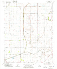
1978 Map of Denton
USGS Topo · Published 1979About this map
Pemiscot Bayou and an extensive network of drainage ditches, including Ditch No 4 and Fountain Ditch, define the agricultural landscape of this Bootheel region in the late 1970s. The area is characterized by scattered rural settlements such as Denton, Hermondale, and Covington, established along the transportation corridors of the St Louis-San Francisco and Southwestern St Louis railroads.
Find a feature on this map
41 named features on this map. Tap any name to fly to it.
Don’t see what you’re looking for? This feature index may not catch every label — zoom into the map to look around manually.
Map Details
Editions of this 1978 Denton Map
This is the sole edition of this map. No revisions or reprints were ever made.
Other maps of this area

1934 · Kennett
USGS Topo · 1:62,500

1939 · Blytheville
USGS Topo · 1:62,500

1940 · Kennett
USGS Topo · 1:62,500

1940 · Hayti
USGS Topo · 1:62,500

1941 · Manila
USGS Topo · 1:62,500

1953 · Memphis
USGS Topo · 1:250,000

1955 · Hayti
USGS Topo · 1:62,500

1955 · Blytheville
USGS Topo · 1:62,500

1956 · Kennett
USGS Topo · 1:62,500

1956 · Manila
USGS Topo · 1:62,500