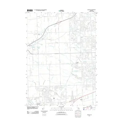
2011 Map of Denton
USGS Topo · Published 2011About this map
Cherry Hill and Willow Run define the landscape of this eastern Michigan survey, where residential development meets a network of historic drainage systems and creeks. The area is marked by a high density of local heritage sites, including the Free Church Cemetery and Pray Cemetery, providing a clear record of local family history and settlement patterns. The Lower River Rouge and Fellows Creek wind through the terrain, illustrating the natural watercourse management that has shaped the growth of Denton and the northern reaches of Ypsilanti. To the west, Frain Lake and Murray Lake stand near the United Memorial Gardens, while the Huron River cuts across the southwestern corner. This era shows the modern road network, including Warren Rd and Geddes Rd, as it integrates with these established cemeteries and waterways.
Find a feature on this map
107 named features on this map. Tap any name to fly to it.
Don’t see what you’re looking for? This feature index may not catch every label — zoom into the map to look around manually.
Map Details
Editions of this 2011 Denton Map
This is the sole edition of this map. No revisions or reprints were ever made.
Other maps of this area

1902 · South Lyon
USGS Topo · 1:62,500

1902 · Ypsilanti
USGS Topo · 1:62,500

1904 · Ann Arbor
USGS Topo · 1:125,000

1905 · Wayne
USGS Topo · 1:62,500

1906 · Ypsilanti
USGS Topo · 1:62,500

1906 · South Lyon
USGS Topo · 1:62,500

1906 · Romulus
USGS Topo · 1:62,500

1908 · Ann Arbor
USGS Topo · 1:125,000

1912 · Wayne
USGS Topo · 1:62,500

1928 · Romulus
USGS Topo · 1:62,500
Featured Places
- Canton Township, MI
- Ypsilanti Charter Township, MI
- Van Buren Charter Township, MI
- Plymouth Charter Township, MI
- Ypsilanti, MI