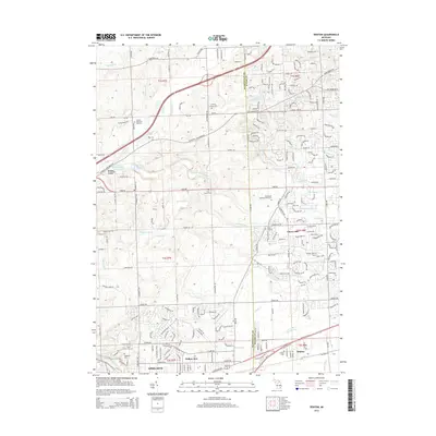
2014 Map of Denton
USGS Topo · Published 2014About this map
Willow Run and the community of Denton anchor the southern portion of this landscape at the Washtenaw and Wayne County border. The terrain is defined by a dense network of drainage systems, including the Lower River Rouge, Fowler Cr, and the Huron River, which flow through an area transitioning from suburban development to open agricultural spaces. Local history is deeply etched into the land here through numerous burial grounds, ranging from the Laraway Family Plot and Pray Cem to larger sites like United Memorial Gardens and Knollwood Memorial Park Cem. To the north, the area around Cherry Hill and Frain Lake shows a pattern of residential growth interspersed with named waterways like Fleming Cr and N Br Fellows Cr. This 2014 survey documents the modern layout of these historic townships just as modern infrastructure began to fully integrate these once-separate village centers into the greater metropolitan corridor.
Find a feature on this map
217 named features on this map. Tap any name to fly to it.
Don’t see what you’re looking for? This feature index may not catch every label — zoom into the map to look around manually.
Map Details
Editions of this 2014 Denton Map
This is the sole edition of this map. No revisions or reprints were ever made.
Other maps of this area

1902 · South Lyon
USGS Topo · 1:62,500

1902 · Ypsilanti
USGS Topo · 1:62,500

1904 · Ann Arbor
USGS Topo · 1:125,000

1905 · Wayne
USGS Topo · 1:62,500

1906 · Ypsilanti
USGS Topo · 1:62,500

1906 · South Lyon
USGS Topo · 1:62,500

1906 · Romulus
USGS Topo · 1:62,500

1908 · Ann Arbor
USGS Topo · 1:125,000

1912 · Wayne
USGS Topo · 1:62,500

1928 · Romulus
USGS Topo · 1:62,500
Featured Places
- Canton Township, MI
- Ypsilanti Charter Township, MI
- Van Buren Charter Township, MI
- Plymouth Charter Township, MI
- Ypsilanti, MI