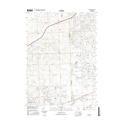
2017 Map of Denton
USGS Topo · Published 2017About this map
Denton and the surrounding borderlands of Washtenaw Co and Wayne Co are shown here during a period of modern suburban transition. The landscape is defined by its deep historical roots, evidenced by numerous small burial grounds and homestead identifiers like the Laraway Family Plot and Kinyon Cem. The southern portion of the map is dominated by the industrial and transport corridor following Michigan Ave and the Michigan Central RR, connecting Willow Run to the eastern edge of Ypsilanti. To the north, the terrain is more varied, drained by the Lower River Rouge and several established agricultural drains. Old thoroughfares like N Territorial Rd and Joy Rd cut through sections of rolling topography, while the settlement at Cherry Hill remains a distinct geographic marker amidst the expanding residential networks of the late 2010s.
Find a feature on this map
71 named features on this map. Tap any name to fly to it.
Don’t see what you’re looking for? This feature index may not catch every label — zoom into the map to look around manually.
Map Details
Editions of this 2017 Denton Map
This is the sole edition of this map. No revisions or reprints were ever made.
Other maps of this area

1902 · South Lyon
USGS Topo · 1:62,500

1902 · Ypsilanti
USGS Topo · 1:62,500

1904 · Ann Arbor
USGS Topo · 1:125,000

1905 · Wayne
USGS Topo · 1:62,500

1906 · Ypsilanti
USGS Topo · 1:62,500

1906 · South Lyon
USGS Topo · 1:62,500

1906 · Romulus
USGS Topo · 1:62,500

1908 · Ann Arbor
USGS Topo · 1:125,000

1912 · Wayne
USGS Topo · 1:62,500

1928 · Romulus
USGS Topo · 1:62,500
Featured Places
- Canton Township, MI
- Ypsilanti Charter Township, MI
- Van Buren Charter Township, MI
- Plymouth Charter Township, MI
- Ypsilanti, MI