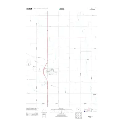
2013 Map of Denver
USGS Topo · Published 2013About this map
Denver serves as the central hub of this Bremer County landscape, where the rectilinear grid of Iowa farmland meets the winding course of Quarter Section Run. The city's street layout is clearly defined by north-south thoroughfares like N State St and S State St, while the surrounding rural landscape is partitioned by an extensive network of numbered roads including 210th St and 260th St. To the east, the meandering Crane Cr provides a natural break in the geometric regularity of the fields, crossed by landmarks such as the Crane Creek Bridge. This 2013 survey illustrates the modern configuration of the region’s agricultural and residential development, showing the persistent influence of the Public Land Survey System on modern local infrastructure.
Find a feature on this map
48 named features on this map. Tap any name to fly to it.
Don’t see what you’re looking for? This feature index may not catch every label — zoom into the map to look around manually.
Map Details
Editions of this 2013 Denver Map
This is the sole edition of this map. No revisions or reprints were ever made.
Other maps of this area

1954 · Waterloo
USGS Topo · 1:250,000

1955 · Waterloo
USGS Topo · 1:250,000

1963 · Waverly
USGS Topo · 1:24,000

1963 · Denver
USGS Topo · 1:24,000

1963 · Cedar Falls
USGS Topo · 1:24,000

1963 · Waterloo North
USGS Topo · 1:24,000

1971 · Readlyn
USGS Topo · 1:24,000

1971 · Bremer
USGS Topo · 1:24,000

1971 · Sumner SW
USGS Topo · 1:24,000

1971 · Dunkerton
USGS Topo · 1:24,000