2022 Map of Denver
USGS Topo · Published 2022About this map
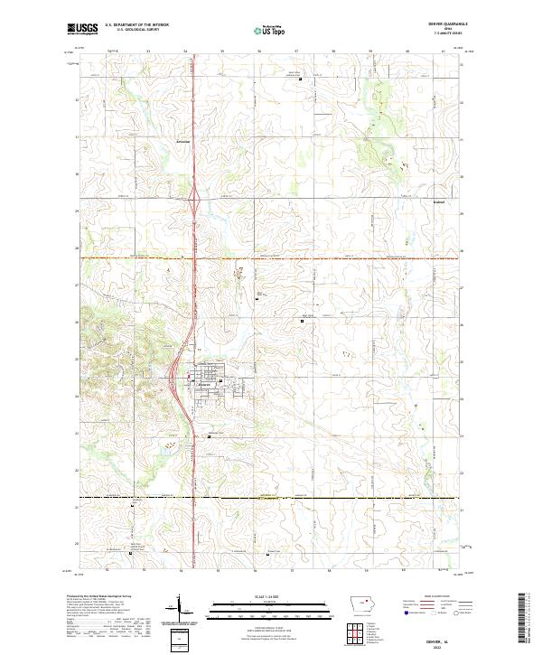
Denver sits at the heart of this Bremer County landscape, where the town's street grid, including Washington St, E Main St, and Prestein Dr, establishes a clear hub within the surrounding agricultural sections. The area is defined by its watercourses, notably Quarter Section Run and the winding path of Crane Creek, which shape the local topography and drainage patterns. Small outlying settlements like Artesian and Knittel provide historical reference points for the rural development of northeastern Iowa.
Find a feature on this map
46 named features on this map. Tap any name to fly to it.
Don’t see what you’re looking for? This feature index may not catch every label — zoom into the map to look around manually.
Map Details
Editions of this 2022 Denver Map
This is the sole edition of this map. No revisions or reprints were ever made.