
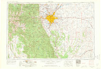
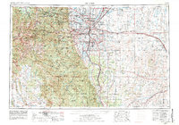
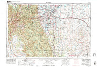
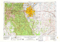
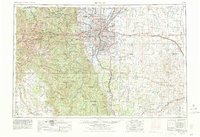
1953 Map of Denver
USGS Topo · Published 1964This historical map portrays the area of Denver in 1953, primarily covering Denver as well as portions of Grand County, El Paso County, Arapahoe County, Jefferson County, Adams County, Douglas County, Boulder County, Summit County, Clear Creek County, Elbert County, Teller County, Broomfield County, Gilpin County, and Park County. Featuring a scale of 1:250000, this map provides a highly detailed snapshot of the terrain, roads, buildings, counties, and historical landmarks in the Denver region at the time. Published in 1964, it is one of 6 known editions of this map due to revisions or reprints.
Find a feature on this map
188 named features on this map. Tap any name to fly to it.
Don’t see what you’re looking for? This feature index may not catch every label — zoom into the map to look around manually.
Map Details
Editions of this 1953 Denver Map
6 editions found
Historical Maps of Dumont Through Time
4 maps found


