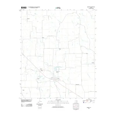
2010 Map of Deport
USGS Topo · Published 2010About this map
Deport serves as the central hub of this agricultural landscape in northeast Texas, where a grid of rural roads connects several small communities and historic burial sites. The area is defined by a dense network of seasonal and permanent waterways, including Mustang Creek, Brushy Creek, and Cuthand Creek, which dictate the placement of local infrastructure. For genealogists and local historians, the presence of multiple cemeteries such as Wrights Chapel Cemetery, Highland Cemetery, and Mount Pleasant Cemetery provides essential markers of early settlement patterns near these watercourses. Significant water management features are evident south of Hoover, specifically the Soil Conservation Service Site 1 Reservoir and its associated dam. The map also documents smaller settlements like Byrdtown and Shadowland, illustrating the enduring nature of these rural townships in Lamar County during the early twenty-first century.
Find a feature on this map
69 named features on this map. Tap any name to fly to it.
Don’t see what you’re looking for? This feature index may not catch every label — zoom into the map to look around manually.
Map Details
Editions of this 2010 Deport Map
This is the sole edition of this map. No revisions or reprints were ever made.
Other maps of this area

1953 · Texarkana
USGS Topo · 1:250,000

1956 · Texarkana
USGS Topo · 1:250,000

1963 · Minter
USGS Topo · 1:24,000

1963 · Cunningham
USGS Topo · 1:24,000

1964 · Detroit
USGS Topo · 1:24,000

1964 · Deport
USGS Topo · 1:24,000

1964 · Bagwell
USGS Topo · 1:24,000

1964 · Pattonville
USGS Topo · 1:24,000

1964 · Bogata
USGS Topo · 1:24,000

1964 · Blossom
USGS Topo · 1:24,000