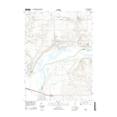
2015 Map of Depue
USGS Topo · Published 2015About this map
Hennepin and Depue anchor this portion of the Illinois River valley, where a complex network of backwater lakes and industrial ponds defines the riverside landscape. The river corridor is punctuated by features such as Depue Lake, Lyons Lake, and Spring Lake, while smaller settlements like Seatonville and Hollowayville occupy the higher ground to the north. This 2015 edition documents the intricate local drainage patterns of Allforks Cr and Negro Cr as they feed into the larger river system.
Find a feature on this map
84 named features on this map. Tap any name to fly to it.
Don’t see what you’re looking for? This feature index may not catch every label — zoom into the map to look around manually.
Map Details
Editions of this 2015 Depue Map
This is the sole edition of this map. No revisions or reprints were ever made.
Other maps of this area

1893 · Lacon
USGS Topo · 1:62,500

1893 · Hennepin
USGS Topo · 1:62,500

1893 · Lasalle
USGS Topo · 1:62,500

1909 · Hennepin
USGS Topo · 1:62,500

1911 · La Salle
USGS Topo · 1:62,500

1911 · Hennepin
USGS Topo · 1:62,500

1913 · La Salle
USGS Topo · 1:62,500

1933 · Lacon
USGS Topo · 1:62,500

1934 · Wenona
USGS Topo · 1:48,000

1937 · Lacon
USGS Topo · 1:62,500