
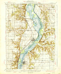
1937 Map of Lacon
USGS Topo · Published 1937About this map
The Illinois River serves as the central artery for this 1930s survey, carving a wide valley filled with backwater lakes and sloughs. Settled river towns like Henry and Lacon anchor the banks, connected by bridges that cross complex water systems including Senachwine Lake, Sawmill Lake, and Billsbach Lake. The landscape transition from the river bottom to the surrounding prairie is marked by a dense network of early 20th-century rural infrastructure.
Find a feature on this map
79 named features on this map. Tap any name to fly to it.
Don’t see what you’re looking for? This feature index may not catch every label — zoom into the map to look around manually.
Map Details
Editions of this 1937 Lacon Map
2 editions found
Other maps of this area

1893 · Lacon
USGS Topo · 1:62,500

1893 · Hennepin
USGS Topo · 1:62,500

1893 · Metamora
USGS Topo · 1:62,500

1893 · Dunlap
USGS Topo · 1:62,500

1893 · Lasalle
USGS Topo · 1:62,500

1898 · Dunlap
USGS Topo · 1:62,500

1909 · Hennepin
USGS Topo · 1:62,500

1911 · La Salle
USGS Topo · 1:62,500

1911 · Hennepin
USGS Topo · 1:62,500

1913 · La Salle
USGS Topo · 1:62,500