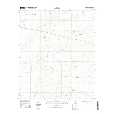
2013 Map of Derrick Draw
USGS Topo · Published 2013About this map
Greer Ranch and King Ranch anchor the northern landscape of this Chaves County expanse, where the high desert terrain is defined by dry watercourses and isolated ranching outposts. The drainage of Long Arroyo cuts across the northern townships, while the namesake Derrick Draw and the broad depression of Buffalo Valley dominate the southern half of the sheet. This area illustrates the essential infrastructure of New Mexico livestock operations, centered on a network of remote water sources. For genealogists and local historians, the map identifies specific family-named landmarks including Derrick Ranch and several functional outposts such as Rattlesnake Windmill, Walker Windmill, Calhoun Windmill, and Cullins Windmill. These features, connected by rural routes like NM-249 and Harriet Rd, reveal the sparse but organized settlement pattern of the Pecos Valley backcountry.
Find a feature on this map
27 named features on this map. Tap any name to fly to it.
Don’t see what you’re looking for? This feature index may not catch every label — zoom into the map to look around manually.
Map Details
Editions of this 2013 Derrick Draw Map
This is the sole edition of this map. No revisions or reprints were ever made.
Other maps of this area

1950 · Dexter East
USGS Topo · 1:24,000

1951 · Ninemile Well
USGS Topo · 1:24,000

1951 · King Camp
USGS Topo · 1:24,000

1951 · Diamond Mound
USGS Topo · 1:24,000

1951 · Hagerman
USGS Topo · 1:24,000

1952 · Connor Well
USGS Topo · 1:24,000

1952 · Bar C Bar Ranch
USGS Topo · 1:24,000

1953 · Basin Well
USGS Topo · 1:24,000

1954 · Carlsbad
USGS Topo · 1:250,000

1955 · Artesia NE
USGS Topo · 1:24,000