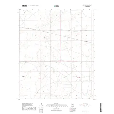
2020 Map of Derrick Draw
USGS Topo · Published 2020About this map
Buffalo Valley defines the northern reaches of this Chaves County landscape, where the high desert terrain is marked by the intermittent drainage of Long Arroyo. The map reveals a transition from open range to a more structured grid of rural access roads, centered around the Derrick Draw feature. The road network, including Aberdeen Rd and Harriet Rd, suggests a modern pattern of land use and property division common in this part of southeastern New Mexico. The geography is characterized by the subtle elevation changes of the Llano Estacado's fringes, with many local routes like Katrina Rd and Elaine Rd named after individuals, providing a personal touch to the vast public land survey system divisions.
Find a feature on this map
16 named features on this map. Tap any name to fly to it.
Don’t see what you’re looking for? This feature index may not catch every label — zoom into the map to look around manually.
Map Details
Editions of this 2020 Derrick Draw Map
This is the sole edition of this map. No revisions or reprints were ever made.
Other maps of this area

1950 · Dexter East
USGS Topo · 1:24,000

1951 · Ninemile Well
USGS Topo · 1:24,000

1951 · King Camp
USGS Topo · 1:24,000

1951 · Diamond Mound
USGS Topo · 1:24,000

1951 · Hagerman
USGS Topo · 1:24,000

1952 · Connor Well
USGS Topo · 1:24,000

1952 · Bar C Bar Ranch
USGS Topo · 1:24,000

1953 · Basin Well
USGS Topo · 1:24,000

1954 · Carlsbad
USGS Topo · 1:250,000

1955 · Artesia NE
USGS Topo · 1:24,000