
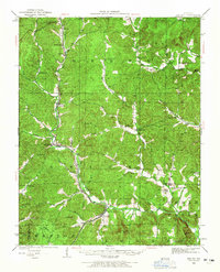
1926 Map of Des Arc
USGS Topo · Published 1960About this map
Annapolis and the neighboring settlement of Des Arc serve as the primary anchors for this 1926 survey of the Ozark foothills. The Missouri Pacific railroad winds through the river valleys, connecting small communities like Glover, Chloride, and Sabula to the broader regional economy. The landscape is defined by its numerous mountains, including Grassy Mtn, Stony Mtn, and Mudlick Mtn, which frame a dense network of hollows and creeks such as Pond Mill Creek and Crane Pond Creek.
Find a feature on this map
69 named features on this map. Tap any name to fly to it.
Don’t see what you’re looking for? This feature index may not catch every label — zoom into the map to look around manually.
Map Details
Editions of this 1926 Des Arc Map
2 editions found
Other maps of this area

1924 · Edgehill
USGS Topo · 1:62,500

1926 · Edgehill
USGS Topo · 1:62,500

1929 · Des Arc
USGS Topo · 1:62,500

1930 · Coldwater
USGS Topo · 1:62,500

1932 · Piedmont
USGS Topo · 1:62,500

1934 · Greenville
USGS Topo · 1:62,500

1935 · Piedmont
USGS Topo · 1:62,500

1937 · Ironton
USGS Topo · 1:48,000

1939 · Greenville
USGS Topo · 1:62,500

1939 · Fredericktown
USGS Topo · 1:48,000