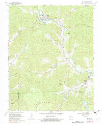
1969 Map of Des Arc
USGS Topo · Published 1983About this map
Annapolis and Des Arc anchor this corner of the Missouri Ozarks, connected by the Missouri Pacific railroad corridor that winds through the valley of Big Creek. The landscape is defined by its deep hollows and named ridges, including Sutton Hollow and Ruble Mountain. High points are marked by landmarks like the Vulcan Lookout Tower, while the lower terrain features the Black River and the Chain of Lakes. For family historians, the sheet is exceptionally detailed with rural burial sites, such as Lewis Cem, Sisk Cem, and Mountain View Cem. The presence of a Quarry and a Mine near Vulcan points to the area's geological and industrial ties, while the New Peace and Harmony Ch stands as a focal point for the local community near the northern boundary.
Find a feature on this map
45 named features on this map. Tap any name to fly to it.
Don’t see what you’re looking for? This feature index may not catch every label — zoom into the map to look around manually.
Map Details
Editions of this 1969 Des Arc Map
3 editions found
Other maps of this area

1926 · Des Arc
USGS Topo · 1:62,500

1929 · Des Arc
USGS Topo · 1:62,500

1932 · Piedmont
USGS Topo · 1:62,500

1935 · Piedmont
USGS Topo · 1:62,500

1943 · Ellington
USGS Topo · 1:62,500

1943 · Lesterville
USGS Topo · 1:62,500

1945 · Ellington
USGS Topo · 1:62,500

1946 · Lesterville
USGS Topo · 1:62,500

1949 · Rolla
USGS Topo · 1:250,000

1953 · Rolla
USGS Topo · 1:250,000