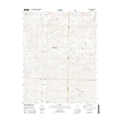
2015 Map of Des Arc NE
USGS Topo · Published 2015About this map
The Saint Francois Mountains define the northern reaches of this Missouri landscape, where the Mark Twain National Forest blankets the terrain. The map reveals a high density of small family or community burial grounds, including the Black Mountain Cemetery, Shoemaker Cemetery, and White Cemetery, many tucked into the hollows that cross the Iron and Madison county line. These hollows, such as Reader Hollow and Tilk Hollow, serve as natural corridors for local watercourses like Crane Pond Cr and Leatherwood Cr. The southern portion of the sheet is anchored by Crane Lake, while the northern hills are marked by the prominent Patterson Mtn. This network of remote cemeteries and winding creek beds provides a clear look at the persistent rural settlement patterns in the Ozark foothills during the early twenty-first century.
Find a feature on this map
40 named features on this map. Tap any name to fly to it.
Don’t see what you’re looking for? This feature index may not catch every label — zoom into the map to look around manually.
Map Details
Editions of this 2015 Des Arc NE Map
This is the sole edition of this map. No revisions or reprints were ever made.
Other maps of this area

1926 · Des Arc
USGS Topo · 1:62,500

1929 · Des Arc
USGS Topo · 1:62,500

1930 · Coldwater
USGS Topo · 1:62,500

1937 · Ironton
USGS Topo · 1:48,000

1939 · Fredericktown
USGS Topo · 1:48,000

1945 · Ironton
USGS Topo · 1:62,500

1946 · Ironton
USGS Topo · 1:62,500

1947 · Fredericktown
USGS Topo · 1:62,500

1949 · Rolla
USGS Topo · 1:250,000

1949 · Coldwater
USGS Topo · 1:62,500