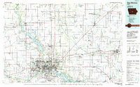
1984 Map of Des Moines
USGS Topo · Published 1985About this map
The Des Moines River and its major impoundments, Saylorville Lake and Big Creek Lake, anchor this mid-1980s look at central Iowa. This regional study reveals the suburban expansion of the state capital alongside its deep-rooted agricultural and institutional foundations. Institutional footprints are prominent, from the sprawling Camp Dodge Military Reservation and the Woodward State Hospital to the Iowa State Univ Experimental Farm south of Ames.
Find a feature on this map
148 named features on this map. Tap any name to fly to it.
Don’t see what you’re looking for? This feature index may not catch every label — zoom into the map to look around manually.
Map Details
Editions of this 1984 Des Moines Map
2 editions found
Other maps of this area

1905 · Des Moines
USGS Topo · 1:62,500

1907 · Des Moines
USGS Topo · 1:62,500

1908 · Waukee
USGS Topo · 1:62,500

1909 · Knoxville
USGS Topo · 1:62,500

1910 · Milo
USGS Topo · 1:62,500

1910 · Pella
USGS Topo · 1:62,500

1911 · Madrid
USGS Topo · 1:62,500

1911 · Slater
USGS Topo · 1:62,500

1912 · Knoxville
USGS Topo · 1:62,500

1912 · Pella
USGS Topo · 1:62,500